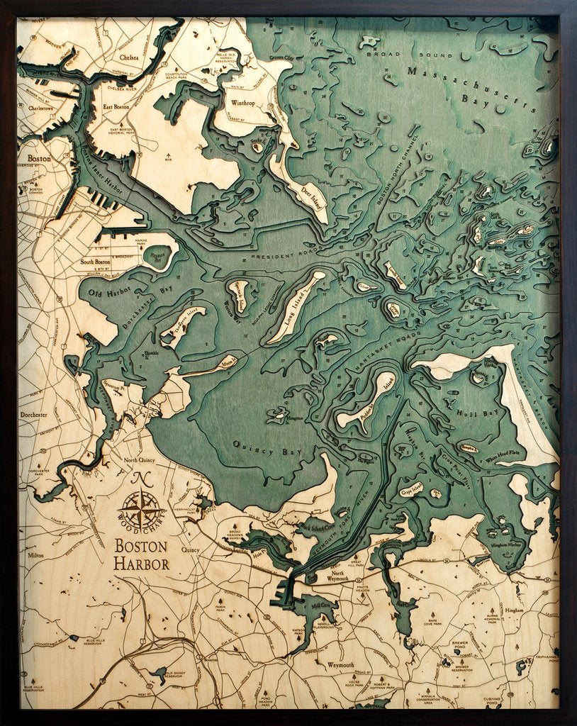
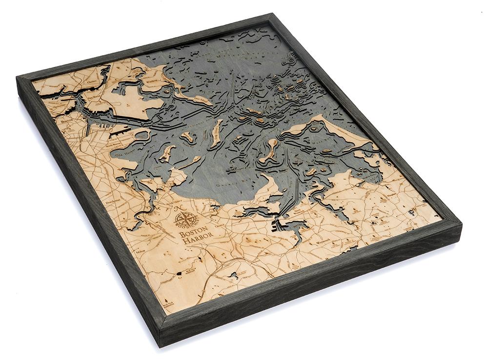
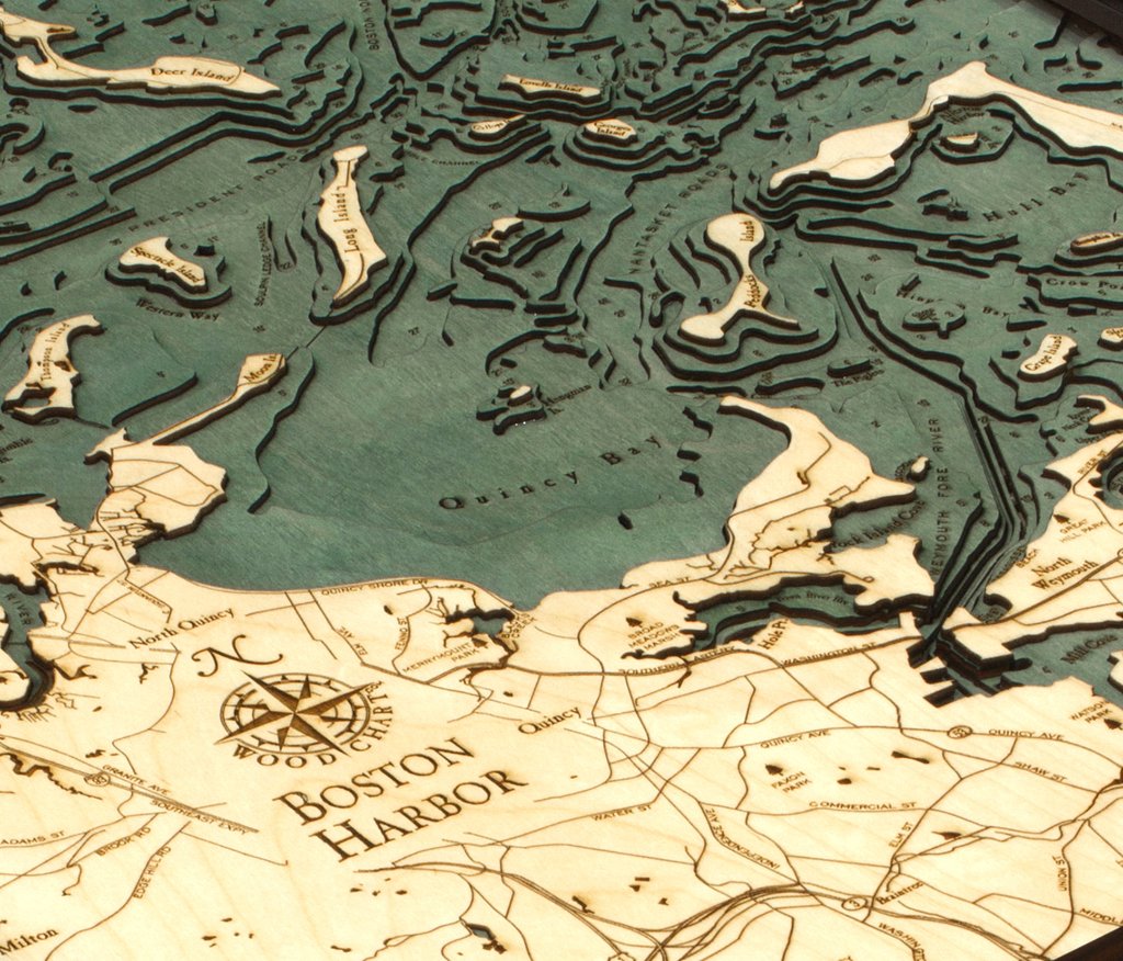

Boston Harbor, Massachusetts 3-D Nautical Wood Chart, Large, 24.5" x 31"
24 people are viewing this right now
Regular price
$328.00
Sale price
$328.00
Regular price
Description
Shipping Policy
Returns & Exchange Policy
WoodChart's beautiful map of Boston Harbor. A 3-D nautical wood map featuring Boston Harbor, Massachusetts.
Boston Harbor is a natural harbor and estuary of Massachusetts Bay, and is adjacent to the city of Boston. Since its discovery by John Smith in 1614, Boston Harbor has been an important port in American history. It was the site of the Boston Tea Party, in 1773, which escalated into the American Revolution.
Points of Interest Include:
Boston, Winthrop, Chelsea, Dorchester, Weymouth, Georges Island, , and Little Brewster Island, home to America's oldest lighthouse.
Our wood charts are made from Baltic birch and have a solid wood frame. They come ready to hang and we will provide free shipping within the continental United States.